|
Geobiology
Geobiology is a field of scientific research that explores the interactions between the physical Earth and the biosphere. It is a relatively young field, and its borders are fluid. There is considerable overlap with the fields of ecology, evolutionary biology, microbiology, paleontology, and particularly soil science and biogeochemistry. Geobiology applies the principles and methods of biology, geology, and soil science to the study of the ancient history of the co-evolution of life and Earth as well as the role of life in the modern world. Geobiologic studies tend to be focused on microorganisms, and on the role that life plays in altering the chemical and physical environment of the pedosphere, which exists at the intersection of the lithosphere, atmosphere, hydrosphere and/or cryosphere. It differs from biogeochemistry in that the focus is on processes and organisms over space and time rather than on global chemical cycles.
Geobiological research synthesizes the geologic record with modern biologic studies. It deals with process - how organisms affect the Earth and vice versa - as well as history - how the Earth and life have changed together. Much research is grounded in the search for fundamental understanding, but geobiology can also be applied, as in the case of microbes that clean up oil spills.
Geobiology employs molecular biology, environmental microbiology, chemical analyses, and the geologic record to investigate the evolutionary interconnectedness of life and Earth. It attempts to understand how the Earth has changed since the origin of life and what it might have been like along the way. Some definitions of geobiology even push the boundaries of this time frame - to understanding the origin of life and to the role that man has played and will continue to play in shaping the Earth in the Anthropocene. (W)
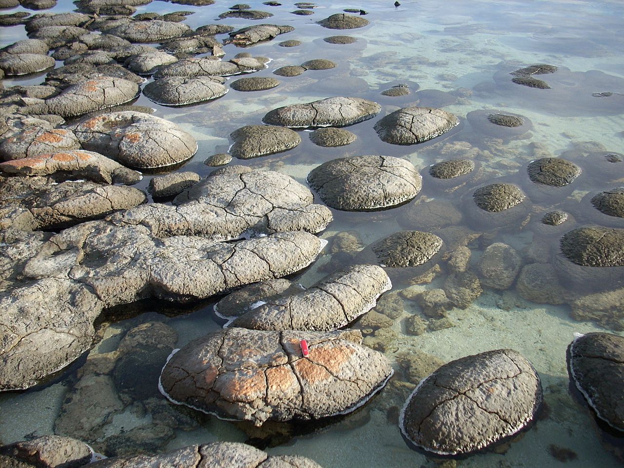
Modern, living stromatolites in Shark Bay, Australia. Shark Bay is one of the few places in the world where stromatolites can be seen today, though they were likely common in ancient shallow seas before the rise of metazoan predators. |
|
|
|
|
Geochronology
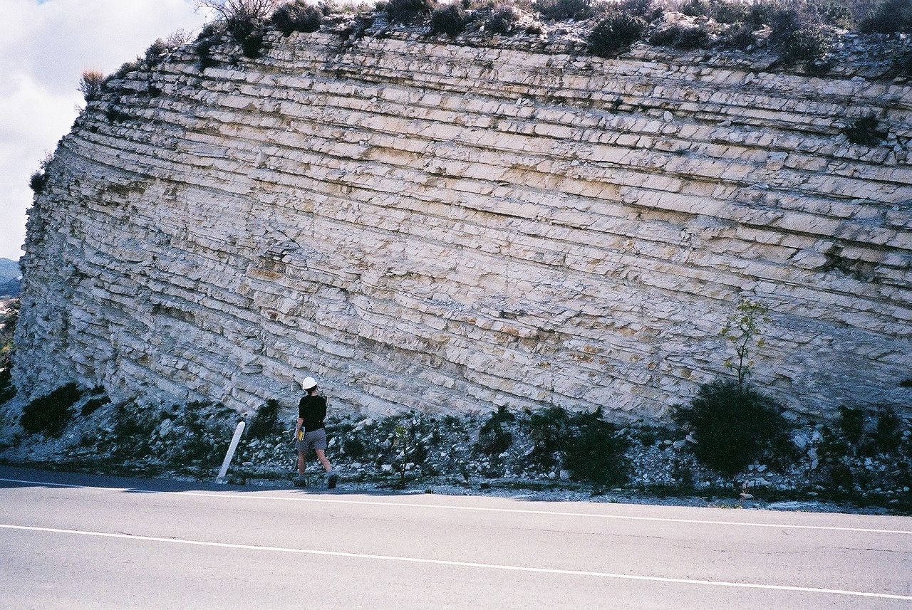
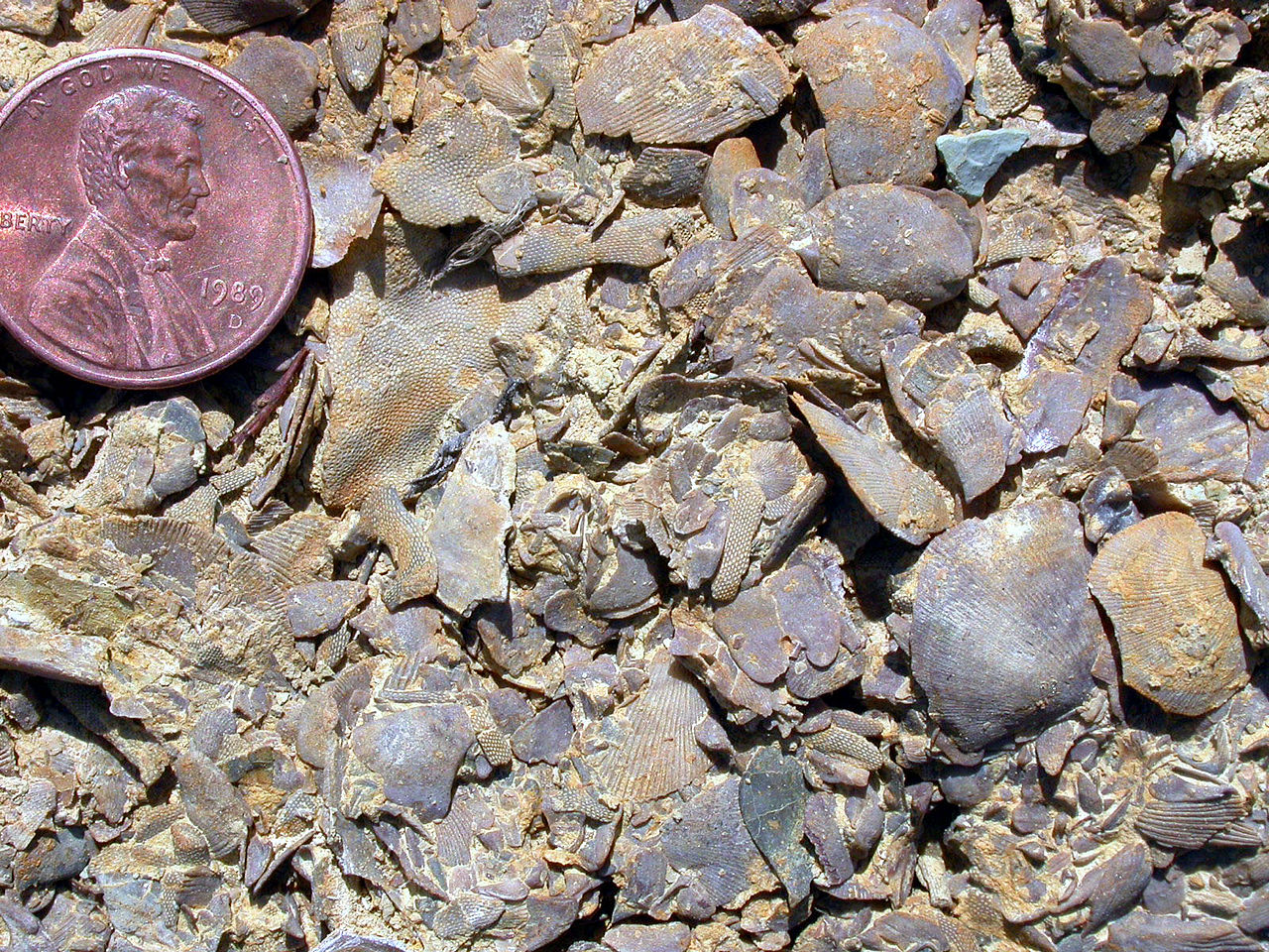
Geochronology is the science of determining the age of rocks, fossils, and sediments using signatures inherent in the rocks themselves. Absolute geochronology can be accomplished through radioactive isotopes, whereas relative geochronology is provided by tools such as palaeomagnetism and stable isotope ratios. By combining multiple geochronological (and biostratigraphic) indicators the precision of the recovered age can be improved.
Geochronology is different in application from biostratigraphy, which is the science of assigning sedimentary rocks to a known geological period via describing, cataloging and comparing fossil floral and faunal assemblages. Biostratigraphy does not directly provide an absolute age determination of a rock, but merely places it within an interval of time at which that fossil assemblage is known to have coexisted. Both disciplines work together hand in hand, however, to the point where they share the same system of naming strata (rock layers) and the time spans utilized to classify sublayers within a stratum.
The science of geochronology is the prime tool used in the discipline of chronostratigraphy, which attempts to derive absolute age dates for all fossil assemblages and determine the geologic history of the Earth and extraterrestrial bodies. (W)
|
|
|
Geography, physical
Physical geography (also known as geosystems or physiography) is one of the two major fields of geography. Physical geography is the branch of natural science which deals with the study of processes and patterns in the natural environment such as the atmosphere, hydrosphere, biosphere, and geosphere, as opposed to the cultural or built environment, the domain of human geography. (W)
📂 Sub-branches (W)
Sub-branches (W)
Physical geography can be divided into several branches or related fields, as follows:
- Geomorphology is concerned with understanding the surface of the Earth and the processes by which it is shaped, both at the present as well as in the past. Geomorphology as a field has several sub-fields that deal with the specific landforms of various environments e.g. desert geomorphology and fluvial geomorphology; however, these sub-fields are united by the core processes which cause them, mainly tectonic or climatic processes. Geomorphology seeks to understand landform history and dynamics, and predict future changes through a combination of field observation, physical experiment, and numerical modeling (Geomorphometry). Early studies in geomorphology are the foundation for pedology, one of two main branches of soil science.
- Hydrology is predominantly concerned with the amounts and quality of water moving and accumulating on the land surface and in the soils and rocks near the surface and is typified by the hydrological cycle. Thus the field encompasses water in rivers, lakes, aquifers and to an extent glaciers, in which the field examines the process and dynamics involved in these bodies of water. Hydrology has historically had an important connection with engineering and has thus developed a largely quantitative method in its research; however, it does have an earth science side that embraces the systems approach. Similar to most fields of physical geography it has sub-fields that examine the specific bodies of water or their interaction with other spheres e.g. limnology and ecohydrology.
- Glaciology is the study of glaciers and ice sheets, or more commonly the cryosphere or ice and phenomena that involve ice. Glaciology groups the latter (ice sheets) as continental glaciers and the former (glaciers) as alpine glaciers. Although research in the areas is similar to research undertaken into both the dynamics of ice sheets and glaciers, the former tends to be concerned with the interaction of ice sheets with the present climate and the latter with the impact of glaciers on the landscape. Glaciology also has a vast array of sub-fields examining the factors and processes involved in ice sheets and glaciers e.g. snow hydrology and glacial geology.
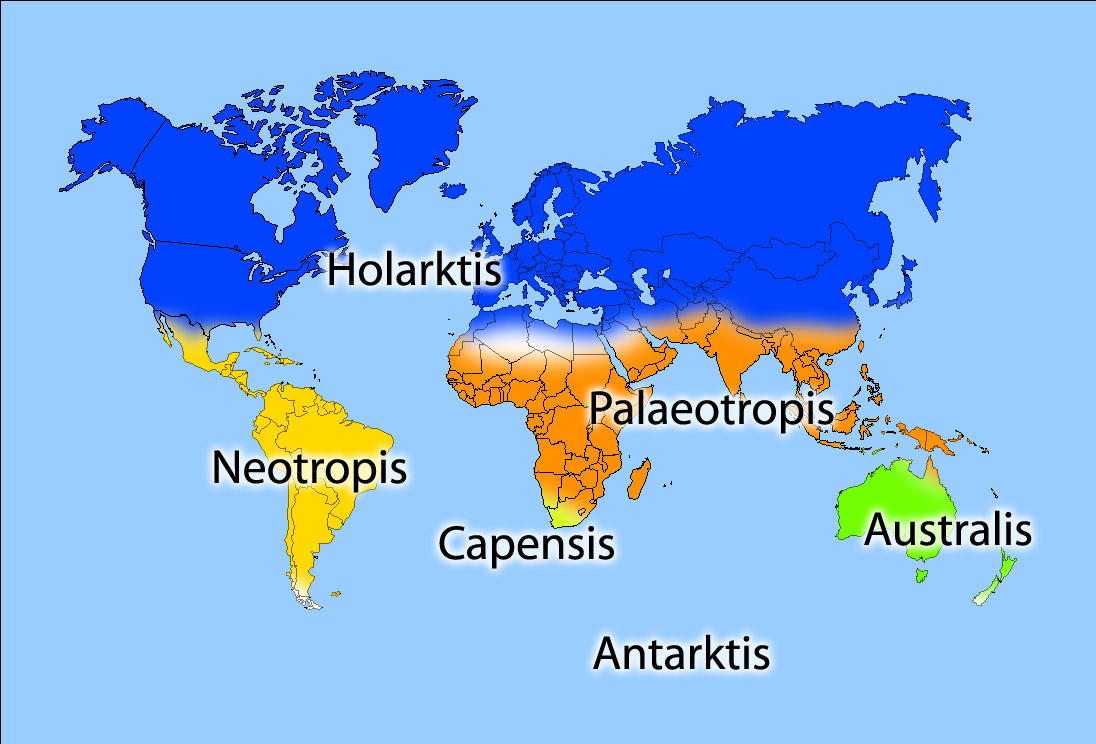
- Biogeography is the science which deals with geographic patterns of species distribution and the processes that result in these patterns. Biogeography emerged as a field of study as a result of the work of Alfred Russel Wallace, although the field prior to the late twentieth century had largely been viewed as historic in its outlook and descriptive in its approach. The main stimulus for the field since its founding has been that of evolution, plate tectonics and the theory of island biogeography. The field can largely be divided into five sub-fields: island biogeography, paleobiogeography, phylogeography, zoogeography and phytogeography
- Climatology is the study of the climate, scientifically defined as weather conditions averaged over a long period of time. Climatology examines both the nature of micro (local) and macro (global) climates and the natural and anthropogenic influences on them. The field is also sub-divided largely into the climates of various regions and the study of specific phenomena or time periods e.g. tropical cyclone rainfall climatology and paleoclimatology.
- Meteorology is the interdisciplinary scientific study of the atmosphere that focuses on weather processes and short term forecasting (in contrast with climatology). Studies in the field stretch back millennia, though significant progress in meteorology did not occur until the eighteenth century. Meteorological phenomena are observable weather events that illuminate and are explained by the science of meteorology.
- Soil geography deals with the distribution of soils across the terrain. This discipline is fundamental to both physical geography and pedology. Pedology is the study of soils in their natural environment. It deals with pedogenesis, soil morphology, soil classification. Soil geography studies the spatial distribution of soils as it relates to topography, climate (water, air, temperature), soil life (micro-organisms, plants, animals) and mineral materials within soils (biogeochemical cycles).
- Palaeogeographyis a cross-disciplinary study that examines the preserved material in the stratigraphic record to determine the distribution of the continents through geologic time. Almost all the evidence for the positions of the continents comes from geology in the form of fossils or paleomagnetism. The use of this data has resulted in evidence for continental drift, plate tectonics, and supercontinents. This, in turn, has supported palaeogeographic theories such as the Wilson cycle.
- Coastal geography is the study of the dynamic interface between the ocean and the land, incorporating both the physical geography (i.e. coastal geomorphology, geology, and oceanography) and the human geography of the coast. It involves an understanding of coastal weathering processes, particularly wave action, sediment movement and weathering, and also the ways in which humans interact with the coast. Coastal geography, although predominantly geomorphological in its research, is not just concerned with coastal landforms, but also the causes and influences of sea level change.
- Oceanography is the branch of physical geography that studies the Earth's oceans and seas. It covers a wide range of topics, including marine organisms and ecosystem dynamics (biological oceanography); ocean currents, waves, and geophysical fluid dynamics (physical oceanography); plate tectonics and the geology of the sea floor (geological oceanography); and fluxes of various chemical substances and physical properties within the ocean and across its boundaries (chemical oceanography). These diverse topics reflect multiple disciplines that oceanographers blend to further knowledge of the world ocean and understanding of processes within it.
- Quaternary science is an interdisciplinary field of study focusing on the Quaternary period, which encompasses the last 2.6 million years. The field studies the last ice age and the recent interstadial the Holocene and uses proxy evidence to reconstruct the past environments during this period to infer the climatic and environmental changes that have occurred.
- Landscape ecology is a sub-discipline of ecology and geography that address how spatial variation in the landscape affects ecological processes such as the distribution and flow of energy, materials, and individuals in the environment (which, in turn, may influence the distribution of landscape "elements" themselves such as hedgerows). The field was largely funded by the German geographer Carl Troll. Landscape ecology typically deals with problems in an applied and holistic context. The main difference between biogeography and landscape ecology is that the latter is concerned with how flows or energy and material are changed and their impacts on the landscape whereas the former is concerned with the spatial patterns of species and chemical cycles.
- Geomatics is the field of gathering, storing, processing, and delivering geographic information, or spatially referenced information. Geomatics includes geodesy (scientific discipline that deals with the measurement and representation of the earth, its gravitational field, and other geodynamic phenomena, such as crustal motion, oceanic tides, and polar motion), geographical information science (GIS) and remote sensing (the short or large-scale acquisition of information of an object or phenomenon, by the use of either recording or real-time sensing devices that are not in physical or intimate contact with the object).
- Environmental geography is a branch of geography that analyzes the spatial aspects of interactions between humans and the natural world. The branch bridges the divide between human and physical geography and thus requires an understanding of the dynamics of geology, meteorology, hydrology, biogeography, and geomorphology, as well as the ways in which human societies conceptualize the environment. Although the branch was previously more visible in research than at present with theories such as environmental determinism linking society with the environment. It has largely become the domain of the study of environmental management or anthropogenic influences.
|
|

|
|
|
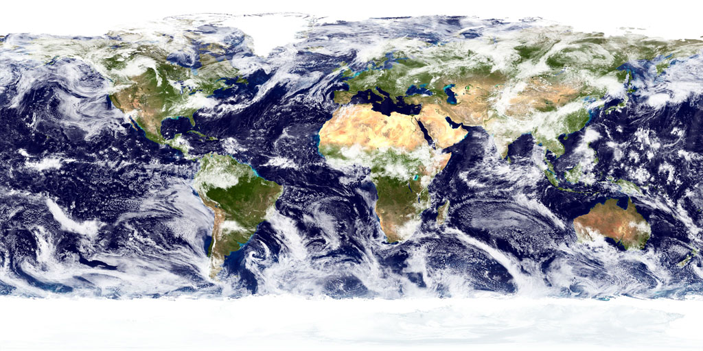
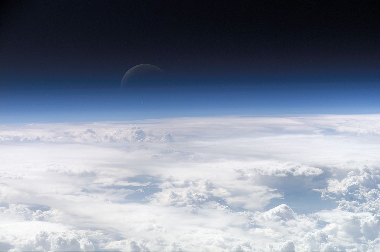
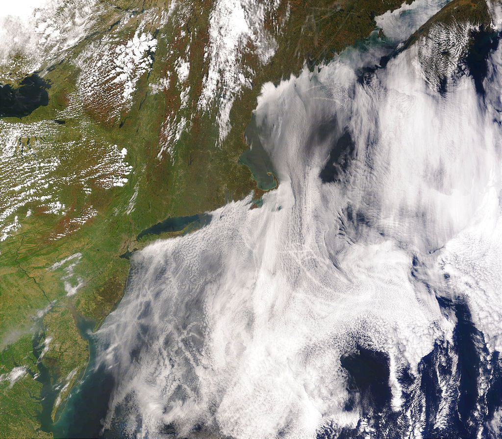
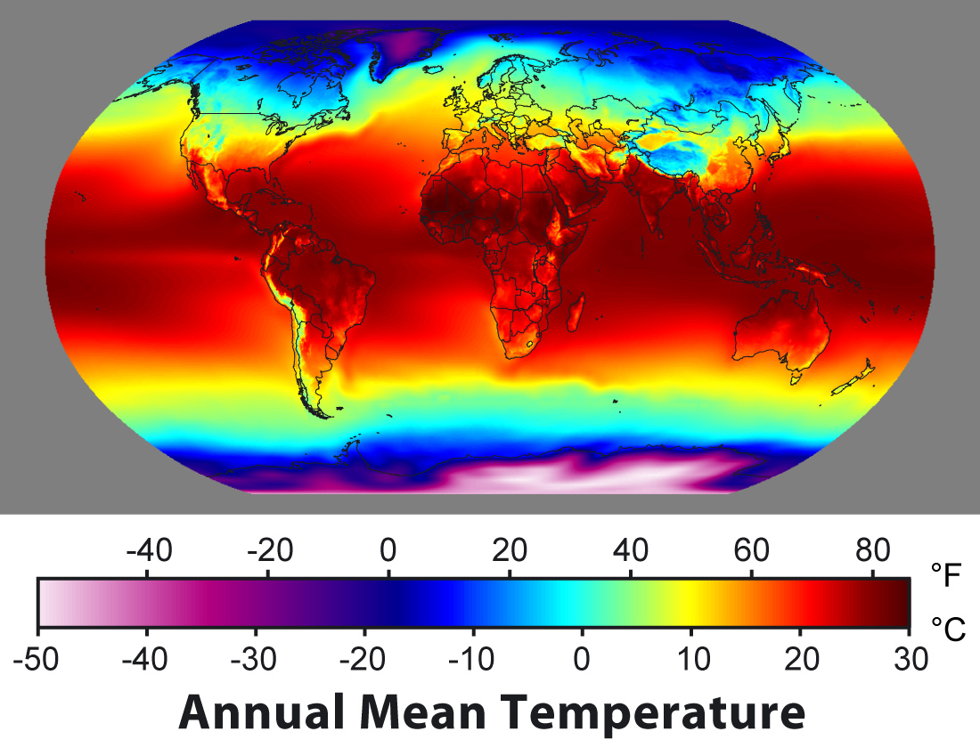
NASA true-color image of the Earth's surface and atmosphere. |
|
|
|
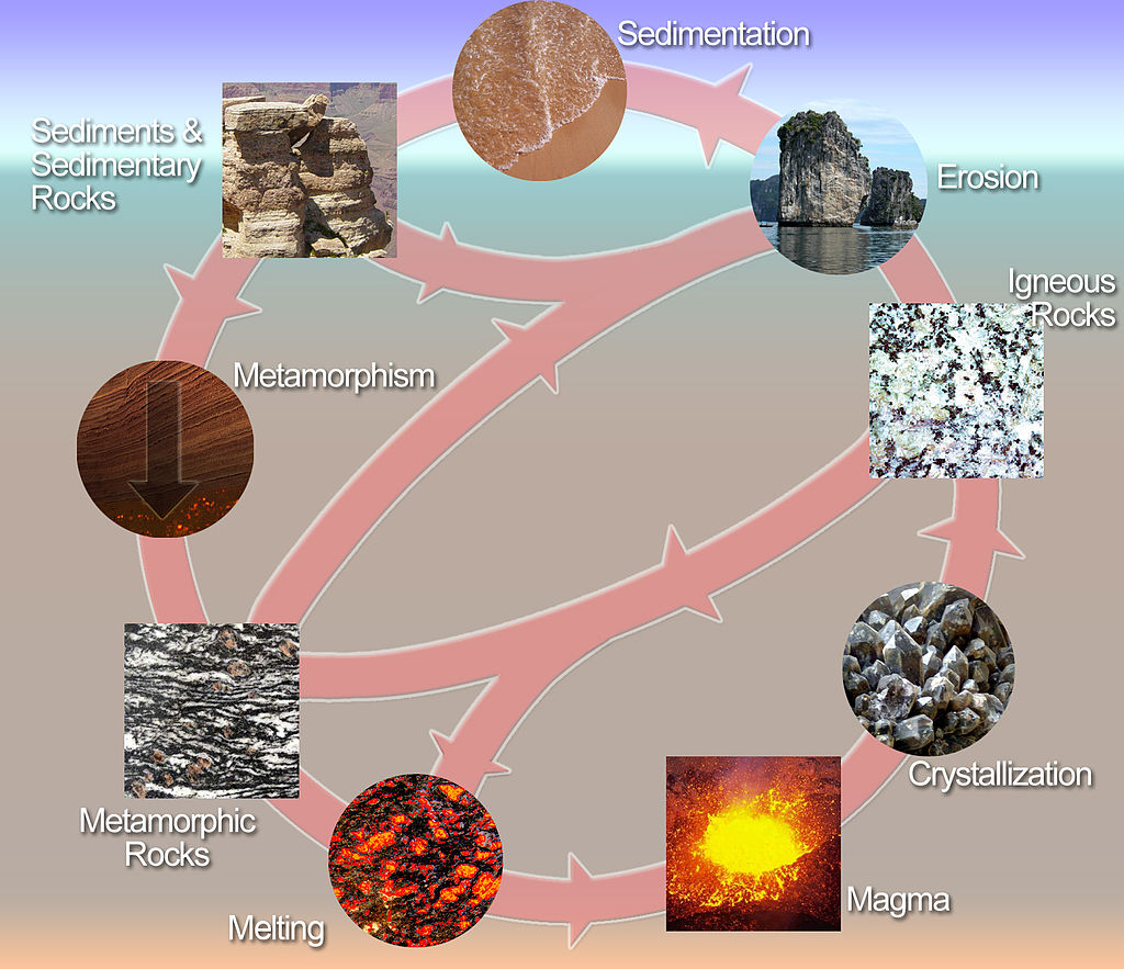
Geology
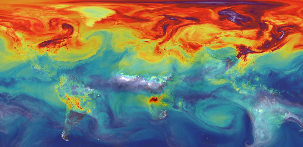
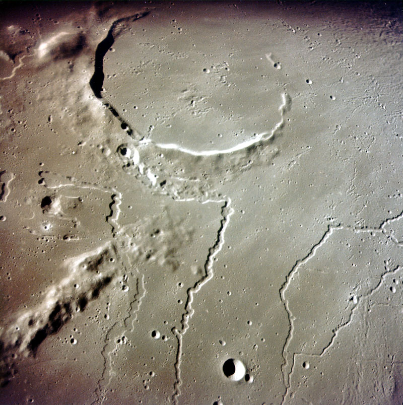
Geology (from the Ancient Greek γῆ, gē ("earth") and -λoγία, -logia, ("study of", "discourse") is an earth science concerned with the solid Earth, the rocks of which it is composed, and the processes by which they change over time. Geology can also include the study of the solid features of any terrestrial planet or natural satellite such as Mars or the Moon. Modern geology significantly overlaps all other earth sciences, including hydrology and the atmospheric sciences, and so is treated as one major aspect of integrated earth system science and planetary science.
Geology describes the structure of the Earth on and beneath its surface, and the processes that have shaped that structure. It also provides tools to determine the relative and absolute ages of rocks found in a given location, and also to describe the histories of those rocks. By combining these tools, geologists are able to chronicle the geological history of the Earth as a whole, and also to demonstrate the age of the Earth. Geology provides the primary evidence for plate tectonics, the evolutionary history of life, and the Earth's past climates.
Geologists use a wide variety of methods to understand the Earth's structure and evolution, including field work, rock description, geophysical techniques, chemical analysis, physical experiments, and numerical modelling. In practical terms, geology is important for mineral and hydrocarbon exploration and exploitation, evaluating water resources, understanding of natural hazards, the remediation of environmental problems, and providing insights into past climate change. Geology is a major academic discipline, and it plays an important role in geotechnical engineering. (W)
📂Important milestones on Earth
Important milestones on Earth (W)
|
|
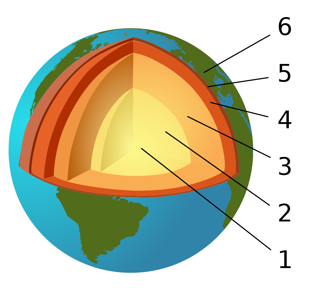
The Earth's layered structure. (1) inner core; (2) outer core; (3) lower mantle; (4) upper mantle; (5) lithosphere; (6) crust (part of the lithosphere). |
|
|
Geologic Clock with events and periods (L)
🔎
|
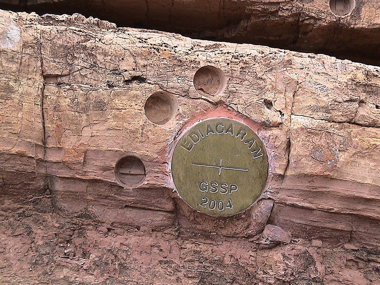
📂Geologic time scale
Geologic time scale (W)
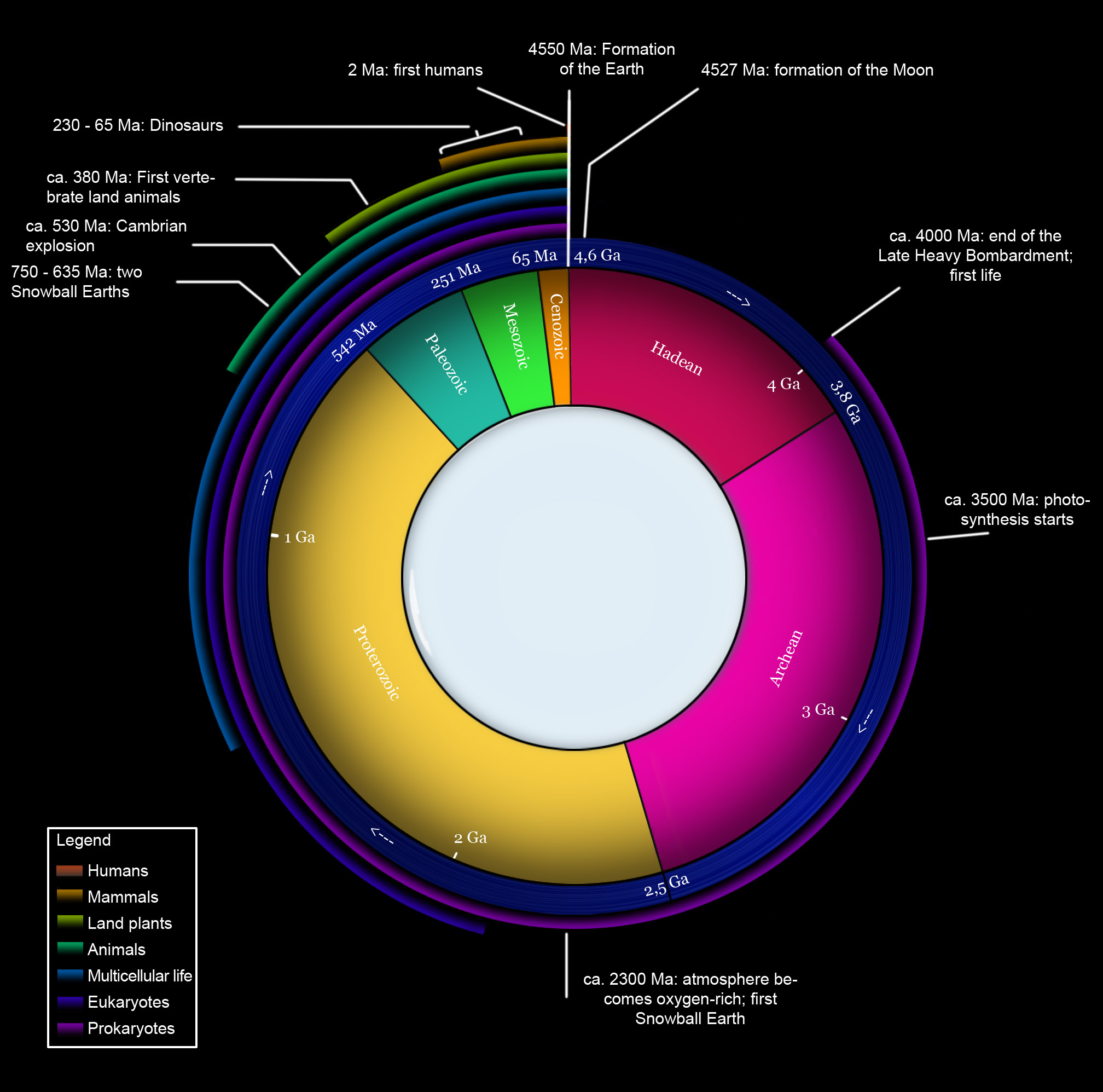
| This clock representation shows some of the major units of geological time and definitive events of Earth history. The Hadean eon represents the time before fossil record of life on Earth; its upper boundary is now regarded as 4.0 Ga (billion years ago). Other subdivisions reflect the evolution of life; the Archean and Proterozoic are both eons, the Palaeozoic, Mesozoic and Cenozoic are eras of the Phanerozoic eon. The three million year Quaternary period, the time of recognizable humans, is too small to be visible at this scale. |
|
|
|
|
|
|
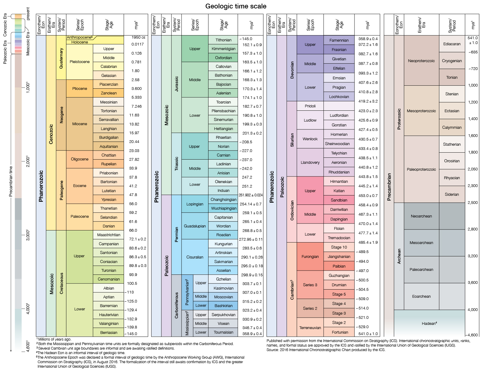
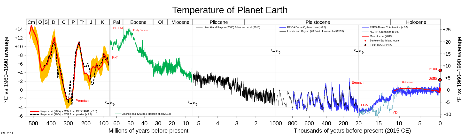
Geologic time scale
The geologic time scale (GTS) is a system of chronological dating that relates geological strata (stratigraphy) to time. It is used by geologists, paleontologists, and other Earth scientists to describe the timing and relationships of events that have occurred during Earth's history. The table of geologic time spans, presented here, agree with the nomenclature, dates and standard color codes set forth by the International Commission on Stratigraphy (ICS).
Terminology
The primary defined divisions of time are eons, in sequence the Hadean, the Archean, the Proterozoic and the Phanerozoic. The first three of these can be referred to collectively as the Precambrian supereon. Eons are divided into eras, which are in turn divided into periods, epochs and ages.
The following four timelines show the geologic time scale. The first shows the entire time from the formation of the Earth to the present, but this gives little space for the most recent eon. Therefore, the second timeline shows an expanded view of the most recent eon. In a similar way, the most recent era is expanded in the third timeline, and the most recent period is expanded in the fourth timeline.
|
Corresponding to eons, eras, periods, epochs and ages, the terms "eonothem", "erathem", "system", "series", "stage" are used to refer to the layers of rock that belong to these stretches of geologic time in Earth's history.
Geologists qualify these units as "early", "mid", and "late" when referring to time, and "lower", "middle", and "upper" when referring to the corresponding rocks. For example, the Lower Jurassic Series in chronostratigraphy corresponds to the Early Jurassic Epoch in geochronology. The adjectives are capitalized when the subdivision is formally recognized, and lower case when not; thus "early Miocene" but "Early Jurassic."
|
|
The stratigraphic chart of geologic time.
🔎
|
|
|
Graphical representation of Earth’s history as a spiral (L)
🔎

|
|
|
|
Geophysics
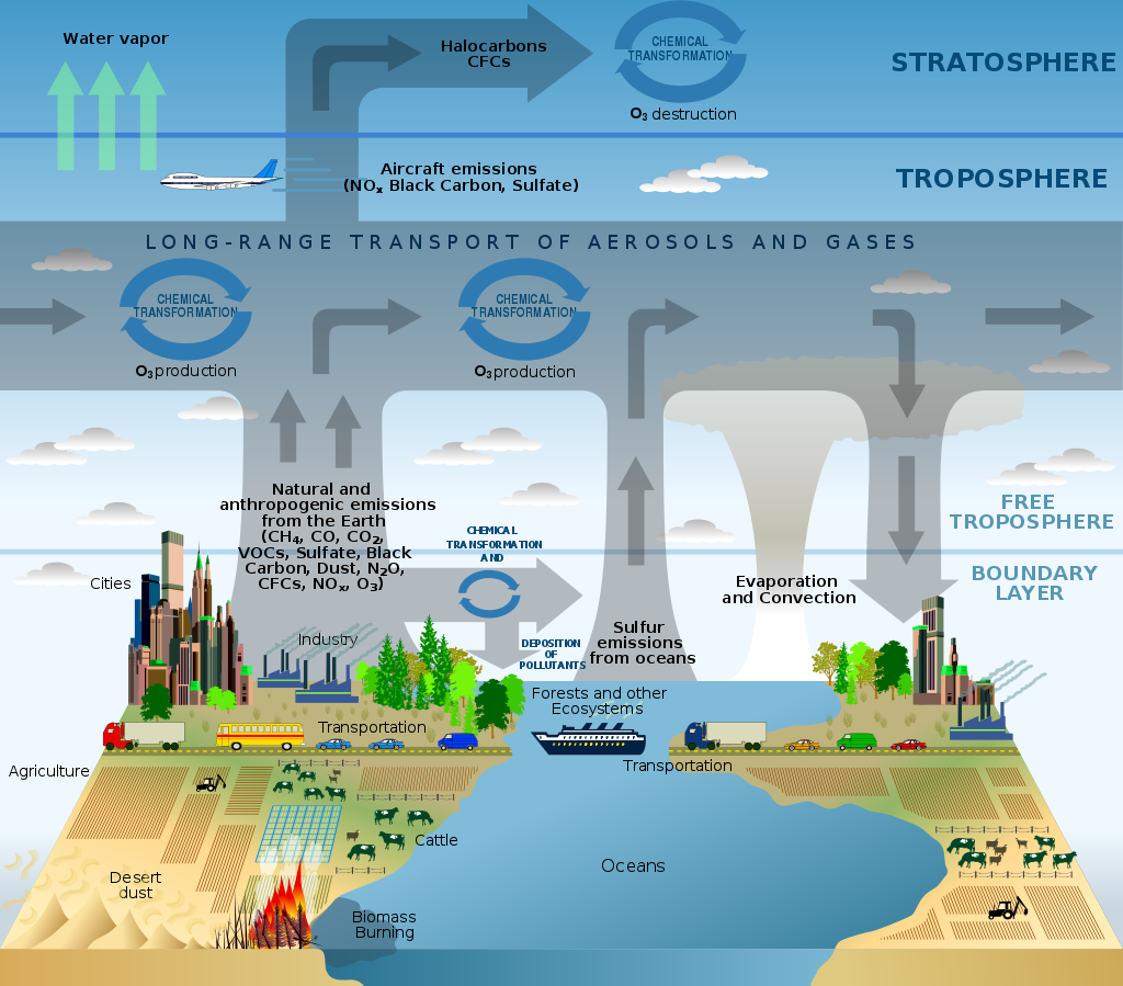
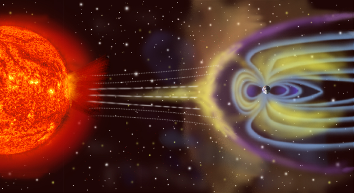
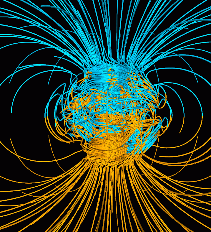
Geophysics is a subject of natural science concerned with the physical processes and physical properties of the Earth and its surrounding space environment, and the use of quantitative methods for their analysis. The term geophysics sometimes refers only to geological applications: Earth's shape; its gravitational and magnetic fields; its internal structure and composition; its dynamics and their surface expression in plate tectonics, the generation of magmas, volcanism and rock formation. However, modern geophysics organizations and pure scientists use a broader definition that includes the water cycle including snow and ice; fluid dynamics of the oceans and the atmosphere; electricity and magnetism in the ionosphere and magnetosphere and solar-terrestrial relations; and analogous problems associated with the Moon and other planets. (w)

Age of the sea floor. Much of the dating information comes from magnetic anomalies. |
|
|
|
|


.jpg)


.jpg)